
Know your Townland – Cloonaherna/Cluain Eithirne
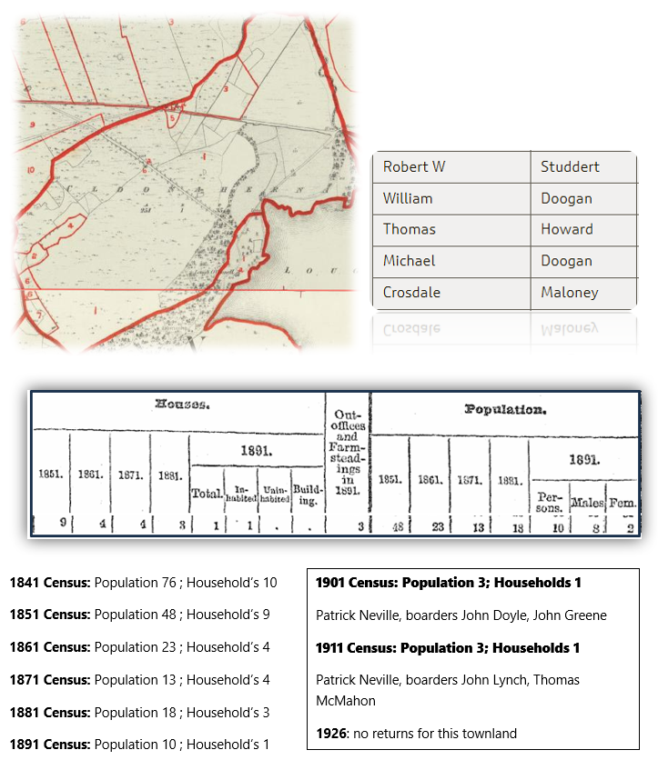
This townland is on the eastern edge of the parish of Quin. If you have walked the path to Cullaun Lake or to the ruins of Cullaun House from the Dangan to Kilkishen road, you have passed through Cloonaherna. It is almost entirely forested and now devoid of population. From a population of 76 in 1841, the number of residents decreased to zero in the following 80 years. The ones that clung on were those employed by the adjoining big house as labourers, coachmen, domestics etc. Records are difficult to find for the people who lived here. Surnames found include Doogan, Howard, Neville, Nash which are not commonly found elsewhere in the parish.
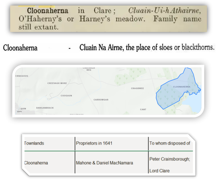
While the English version of the placename has remained largely the same since first recorded as part of the inquisitions, the original Irish and its meaning appears to be not yet settled!
National Monuments
CL035-102— Enclosure
Description: On a very gentle SW-facing slope, located partially within rough pasture, natural woodland and rock outcrop to NW, planted native woodland to NE and the remainder is situated within what appears to be an area of recently planted native woodland. Depicted as an oval area (c. 42m NE-SW; c. 35m NW-SE) on the OS 25-inch map and the 1921 edition of the OS 6-inch map. The enclosing elements can be traced where there are the remains of a collapsed wall (int. H 0.25m; ext. H 0.45m; Wth at top 1.7m; overall Wth 3.5m) SW-W-NW. The collapsed drystone wall continues NW-N-NE, having a later field wall on top, as depicted on the OS 25-inch map. The enclosing elements are obscured by dense briars NE-SW where the enclosure and most of the interior appears to have been planted with trees in relatively recent times. Most of this area is engulfed in briars with trees growing up through these. The monument has been truncated by a townland boundary (long-axis NE-SW) across the WNW-sector.
CL035-099—Ringfort/Enclosure
Description: On a low rise, in native woodland, c. 27m to SSW of a modern dwelling. Depicted on the 1921 edition of the OS 6-inch map and the OS 25-inch map as an oval enclosure (c. 20m N-S; c. 24m E-W) defined by a single enclosing element. Archaeological monitoring of topsoil stripping immediately to the N in advance of the building of a new dwelling (Finn 1999; 2000, 15; Licence no. 99E0153) produced no archaeological material. At that stage the monument was described as being in a poor state of preservation with trees growing across the entire area. The monument was described by Discovery Programme staff (2006, SMR file) as a cashel (int. diam. 29m E-W; 26m N-S) with a well preserved wall (Wth 2.2m; H 1.8m) at E located on a gentle W-facing slope immediately above a steep slope.
References: Finn, D. 1999 Archaeological monitoring of groundworks at Cloonaherna, Cragganowen, Co. Clare. Licence no. 99E0153. Unpublished report, National Monuments Section, Heritage and Planning Division, Department of the Environment, Heritage and Local Government, Dublin. Finn, D. 2000 Cloonaherna. In I. Bennett (ed.), Excavations 1999: summary accounts of archaeological excavations in Ireland, 15 (No. 49). Bray. Wordwell.
CL036—100—Enclosure
Description: On an elevated area, in the plot of a bungalow and abutting woodland to ENE. Depicted on the 25-inch OS map and the 1921 edition of the OS 6-inch map as a circular enclosure (c. 26m NE-SW; 25m NW-SE) defined by a single enclosing element. A field boundary is depicted on the top of the enclosing elements NE-SE. A bungalow occupies the area of the monument, off-centre to SW and the remainder of the monument interior is located within the rear garden. A garden shed is located in the E sector of the interior. An arc (C 25m) of collapsed drystone wall (int. H 0.5m; ext. H 0.45m; Wth at top 0.7m; overall Wth 2.5m) follows the line of the enclosing elements NE-E-SE and forms a boundary between the garden and the native woodland. The boundary is distinctively curvilinear at this point and in contrast it is linear at either side where it continues to form the remainder of the rear boundary. A lot of modern debris is banked up along the inside and top of the field boundary and a lot of vegetation and modern debris is located on the exterior. For this reason, it is not feasible to measure the enclosing elements which appear to be a collapsed stone wall which exists NE-E-SE. There is no trace of this monument in the house plot, except where the remains of the enclosing elements are located below the existing field boundary NE-E-SE.
Compiled by: Mary Tunney, Alison McQueen and Vera Rahilly Date of upload: 20 March 2018
Quin Petty Court Session – sample case
June 28th 1876
Defendant: Bridget Nash
Complainant: Ann Halloran, Gurteen
Complaint: For allowing her two cows to wander onto public road at Gurteen on the 21st June 1876